
.svg)

LumoScanner: 3D laser scanning in just 2 seconds per room
Ultra-fast. Ultra-simple. Consistently precise.
✓ 1 button press, 2 seconds per room
✓ Up to 10× faster than traditional surveying
✓ One-handed operation, no tripod required
✓ No surveying expertise required
✓ Works seamlessly in occupied buildings
✓ No compromises on accuracy
Ultra-fast. Ultra-simple. Consistently precise.
In just 2 seconds per scan, LumoScanner captures rooms and buildings at the press of a button. Its advanced, multi-patented 3D laser scanning technology records the as-built condition of interior spaces, including doors, windows, and built-in elements.
Whether for renovation, planning, or documentation, accurate building measurement is the foundation of every successful project. Our technology combines state-of-the-art laser scanning with exceptional ease of use, delivering reliable data for professionals in architecture, engineering, construction, and energy consulting.

Benefits of the LumoScanner
Radically fast surveying – 2 seconds per room
A single Lumoview scan captures all relevant room data in just 2 seconds – up to 10× faster than traditional surveying methods. In most cases, one scan is sufficient to generate complete and highly accurate results. Building surveys simply don’t get faster than this.
Intuitive one-button operation
Operating the LumoScanner requires just one button press to capture all essential building data. This makes it the only device of its kind that can be used by non-experts – no surveying background required, fully intuitive.
Automatically removes furniture
The LumoScanner automatically filters out furniture, capturing only relevant building data. This minimizes on-site effort and makes it ideal for occupied and in-use buildings – fast, unobtrusive, and with no preparation required.
Automatically removes people
The LumoScanner automatically removes people from scans, ensuring DIN 277–compliant area calculations and GDPR-compliant data handling. At the same time, it reduces on-site disruption – enabling a tenant-friendly surveying process.
World’s first 360° infrared capture of interior spaces
Lumoview is the world’s first system capable of generating thermal panoramic images of interior spaces. This innovative approach helps identify structural weaknesses such as thermal bridges or insulation deficiencies.
one-handed operation – no tripod required
Thanks to our innovative laser technology, movement within the room is no obstacle. Unlike conventional systems, the LumoScanner works without a tripod and can be operated with just one hand – without compromising precision.
Self-service
Rent the LumoScanner and easily capture building data yourself
– flexible, efficient, and without prior knowledge required.
Scan-Service
Our scanning team will visit your location and
take care of the building measurement for you, upon request.
Self-Service vs. Scan-Service
.avif)
Capture App: Intuitive control and secure data handling
The LumoScanner is seamlessly connected to the Capture App, ensuring that all captured data is securely transferred to the LumoCloud. The intuitive user interface allows you to easily create buildings, structure rooms efficiently, manage scans, and synchronize data in real time.
All data is then securely and automatically uploaded to the LumoCloud.If no internet connection is available, the scanner temporarily stores the data offline and synchronizes it as soon as a connection is restored. All data is protected in compliance with GDPR and safeguarded against data loss, allowing you to fully focus on your projects.
What data does the LumoScanner capture?
Geometric data
LiDAR-based point clouds deliver highly precise geometric data, enabling accurate measurement of rooms and building structures.
360-degree room visualization
Comprehensive visual documentation of room layouts, including windows and doors, roof surfaces and wall thicknesses, as well as detailed building elements. People are automatically excluded from the images.
Thermal and climate data
Climate data such as temperature and humidity for analysis and defect detection, along with thermal images to identify energy-related weaknesses.
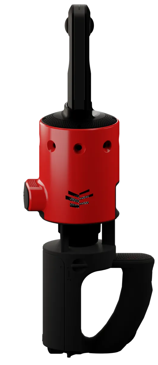
About the LumoScanner
The LumoScanner is a triple-patented, mobile system for terrestrial 3D laser scanning of interior spaces. It combines state-of-the-art technology in a compact, handheld device. Equipped with a range of advanced sensors, the LumoScanner delivers precise and fast reality-capture data for reliable building documentation.
Which sensors does the LumoScanner use?
LiDAR sensor (2D)
LiDAR (Light Detection and Ranging) measures distances and generates a point cloud that represents the geometric structure of a space. The LumoScanner uses rotating 2D LiDAR sensors to accurately capture room geometry, including walls, doors, and windows.
Infrared sensors (8x)
These sensors measure temperature and humidity ranges within the room. They provide precise thermographic data that can be used to identify thermal bridges and potential building defects.
360° camera (Ricoh Theta Z1)
This high-resolution camera captures Full HD 360-degree images of the scanned space, providing complete visual documentation. It enables seamless combination of visual data with LiDAR-based geometry.
Inertial Measurement Unit (IMU, 9-axis)
The IMU measures device movement across three dimensions (X, Y, and Z) and records positional and motion data. This ensures data integrity even when the scanner moves slightly during capture.
Air temperature and humidity sensor
This sensor measures ambient air temperature and humidity, capturing additional environmental data that supports analysis of energy efficiency and building behavior.
Use cases: Who is the LumoScanner for?
The LumoScanner is the most efficient solution for digital building surveying—radically fast, radically simple, and consistently reliable. This makes it the ideal partner for architects, engineers, property owners, and energy consultants who rely on precise, fast, and efficient measurement data, whether for renovation projects, planning, or documentation.
Typical use cases for the LumoScanner include:
- Energy consulting
- Energy-efficient renovation
- Existing building and portfolio management / digital building inventories
Thanks to its intuitive operation, the LumoScanner remains highly reliable and accurate even in the hands of users without surveying expertise. The LumoScanner truly excels in residential buildings and occupied properties. It not only minimizes overall effort but also simplifies on-site work. There is no need to move furniture or rearrange rooms—the technology automatically filters out furniture and people, without compromising data accuracy.
What our customers say about the LumoScanner
“We precisely captured the entire gross floor area of a comprehensive school, including the sports hall—over 2,300 m²—in just one day. That would have been unthinkable before.”
.avif)
“Within just one and a half weeks, we were able to capture around 30,000 m² across multiple buildings using the technology—including complex structures such as churches.”

Frequently asked questions about the LumoScanner
Want to learn more about the LumoScanner? Visit our FAQ or drop us a message!
No. Furniture, people, or other objects do not affect either the scanning process or the quality of the captured data.
All people present in the room during the scan, including the person performing the scan, are automatically anonymized. This ensures compliance with applicable data protection regulations.
Costs depend on several factors, including whether you choose self-scanning or our measurement service, the number of models, the required level of detail, and the size of the building. Individual rooms are generally not offered separately. Please contact us for a customized quote.
The duration depends on the size and complexity of the building. A single room can be scanned in just 2 seconds. Capturing an entire building varies depending on the number, size, and layout of the rooms.
No problem. If the internet connection is lost during scanning, all data is stored locally and automatically synchronized once a connection is available again.
The LumoScanner is available exclusively as a rental solution. You can rent it either for a single project or as part of a subscription. Please contact us for details on available rental models.
With the rental model, you only pay for actual building surveys without upfront investment or ongoing maintenance costs. We take full responsibility for maintenance, updates, and device availability, allowing you to focus entirely on using and analyzing the data.
Start your digital building measurement now
Rent the LumoScanner or book our professional scanning service!
about 3D-laser-scanning
Sind Sie sich noch unsicher, wie Lumoview für die Digitalisierung Ihres Gebäudes genutzt werden kann? Werfen Sie einen Blick auf unsere FAQs oder kontaktieren Sie uns!
3D laser scanning, also known as laser surveying, is a method for capturing the three-dimensional shape of buildings and interior spaces using laser technology. It enables contactless measurement and creates an accurate digital representation of a building. The LumoScanner is a specialized form of terrestrial laser scanning designed for indoor environments.
3D lasers emit millions of laser pulses. The time it takes for these light impulses to reflect off surfaces and return to the sensor (LiDAR) is measured. Based on time and angle, a three-dimensional point cloud is generated, where each point represents a specific position and distance. The result is a detailed, highly accurate, and complete digital representation of the space.
Compared to conventional measurement methods such as tape measures, folding rules, or laser distance meters, which only capture individual points and are therefore prone to errors, 3D laser scanning is significantly more precise, reliable, faster, and more efficient.
A point cloud is a collection of millions of data points within a three-dimensional coordinate system. Each point represents a measured position in space, forming an exact digital representation of a physical object or room.
A digital twin goes beyond pure geometry. It is a virtual replica that includes real-time data and behavior, enabling simulations and advanced analysis.
Point cloud = raw data foundation
Digital twin = dynamic model built on that data
- Terrestrial laser scanning (TLS): The scanner is positioned at a fixed location, typically on a tripod, and repositioned as needed. It is a stationary system scanning outward from a single point. The LumoScanner belongs to this category.
- Handheld scanners: Portable scanners that can be moved freely through space to capture interior areas, complex geometries, and objects. The LumoScanner also fits into this category.
- Mobile laser scanners: Systems where the scanner is mounted on moving platforms such as vehicles, commonly used for capturing linear infrastructure like roads, tunnels, or railways.
- Airborne laser scanning: Lasers mounted on aircraft or helicopters to map large areas such as forests or infrastructure and collect topographic data.
- UAV laser scanning (drone surveying):
Laser scanners mounted on drones for fast and detailed capture of hard-to-access areas such as quarries or agricultural and forestry land. Lumoview also offers drone photogrammetry services. - Industrial scanners: Highly specialized, permanently installed scanners used for technical metrology and industrial plant planning.
Direct outputs include:
- Point clouds as raw data
- 360-degree panoramic images providing color information for photorealistic visualization
Additional data derived from these outputs includes:
- 2D as-built plans such as floor plans, sections, and elevations
- Room boundaries, wall thicknesses, window and door positions, staircases, columns, pillars, and ceiling heights
- 3D models such as mesh models, CAD models, and BIM models
- Thermal data including heat maps for temperature distribution and identification of energy-related weaknesses
- Climate data such as temperature and humidity
- Motion and positioning data captured via the IMU (Inertial Measurement Unit)
Captured point clouds, 2D plans, and sensor data can be processed and used in:
- CAD (Computer-Aided Design): floor plans, sections, elevations, detail drawings
- BIM (Building Information Modeling): 3D as-built models
- CAFM (Computer-Aided Facility Management): area data according to DIN 277 for space and building management
- 3D building models: virtual tours and walkthroughs
In some projects, 3D data can also be used for construction-related reverse engineering, such as digitally reconstructing complex existing structures.
Common interfaces and formats include:
- Point cloud formats: E57, LAS, LAZ, PTS, PTX, RCP/RCS (Autodesk)
- CAD formats: DWG, DXF, DGN
- BIM formats: IFC and tool-specific formats such as RVT (Revit)
- CAFM and area formats: CSV, XLSX
- Image and documentation formats: JPEG, TIFF, system-dependent 360-degree formats, and manufacturer-specific image formats
This is the FAQ text...
This is the FAQ text...
